 At CIMA (Atlantic Center for Environmental Research, S.L.), we want to show you what we do—both in our offices and beyond.
On this page, you’ll find a series of short videos called "Things We Do at CIMA", which will help explain what we do and how we do it. All to bring you closer to the world of Marine Biology and Oceanography.
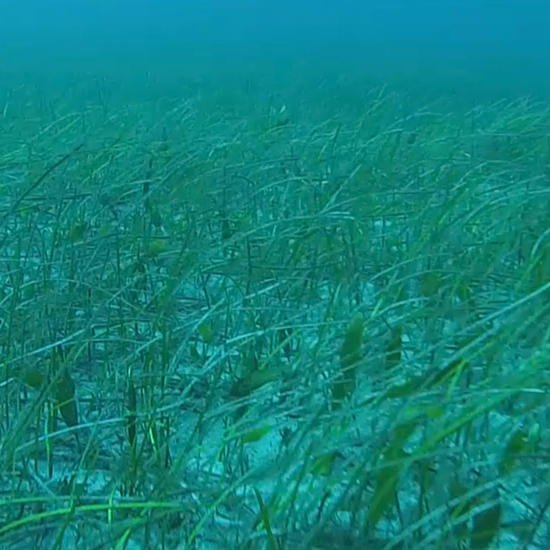
– «Things We Do At CIMA» #2: Vegetation Species Mapping: With this video, we want to show you one of the necessary actions to map seagrass beds sebadales (Cymodocea nodosa) The first step is to draw a series of transectson the map, which are the paths to be followed to observe this marine plant. These same transects are traversed by the Zodiac boat, towing a camera near the seabed that records everything it encounters. These video clips are georeferenced, meaning we know the exact location of areas where seagrass is present. Back in the office, the next task is to review the videos and mark the coordinates of the species’ distribution across the seabed.
Why is this important?
Cymodocea nodosa Cymodocea nodosa is a threatened species and is currently protected. Among its critical roles, it serves as a nursery for fry and juveniles of many marine species. Accurately mapping this species is essential to ensure that coastal activities—such as infrastructure construction, outfalls, etc.—affect it as minimally as possible.